The Auckland Volcanic Field (AVF) contains surface expressions of more than 50 volcanic eruptions (red in the figure below). The last eruption, Rangitoto Island, was only 600 years ago! Why the AVF is here, remains a question to this day. The field is not on a plate boundary, but also not a intraplate volcanic field such as the hotspots of Yellowstone and Hawaii. GeoNet has instrumented the area with a network of seismometers (black circles). 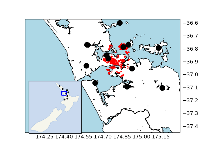 Seismologists monitor the AVF with this network, while the DEVORA project studies the geologic hazard and risk associated with the AVF.
Seismic activity in the area is actually relatively low, but recent advances in seismology allow us to study the subsurface using seismic surface- and body waves.
Surface Waves
Noise of the city and the surrounding oceans generate seismic surface wave energy. We extract information between seismic stations as if one of the seismic stations were the source (the “earthquake”) and the other the recorder. To do this properly for all stations in the AVF, we first need to determine the orientation of each seismic station.
Body Waves
Earthquakes from regional and teleseismic events provide P- and S-waves for body tomography. A synthetic checker-board test helped us determine the expected resolution, after which we embarked on a preliminary tomographic inversion using data from 100+ teleseismic (far away) events.
Comments are closed.