We implement P-wave travel time tomography using FMTOMO, to image the subsurface structure beneath the Auckland Volcanic Field. The input information, which is the residual travel time is obtained using an adaptive stacking code, tcas by Nick Rawlinson. Inversion is then implemented using more than one hundred teleseismic sources.
getting the residual time: tcas
The code tcas works by taking the predicted time (eg. using ak135 1-D Earth model) to a reference station to be compared with other stations. The difference between the predicted time is the base for the approximate initial alignment. Cross correlation is then performed to create the final improved alignment from which we get the residual time from the 1D-Earth model that we used.
-
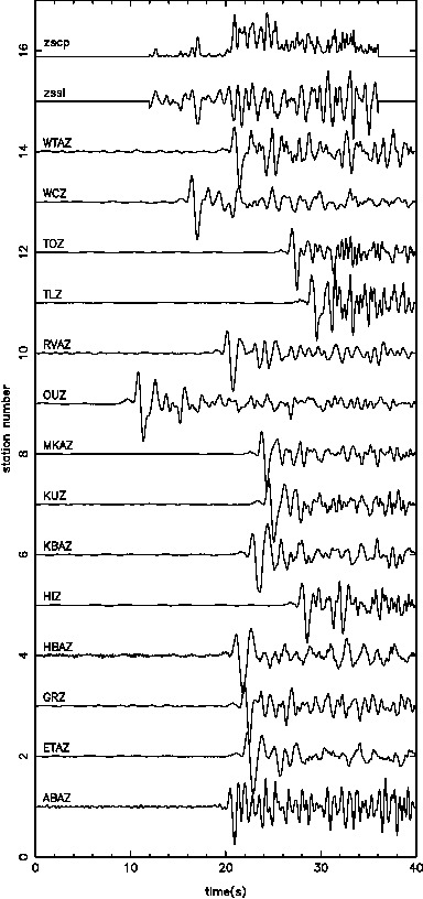
- Raw data
-
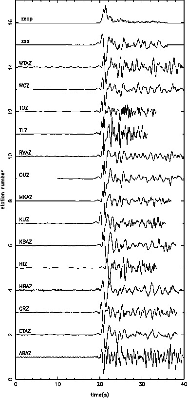
- Initial alignment
-
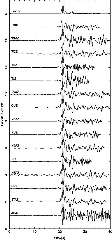
- Final alignment
teleseismic inversion
We apply to the tcas code 131 earthquakes limited to epicentral distance greater than 27 degrees to avoid triplication of the P-wave arrival.
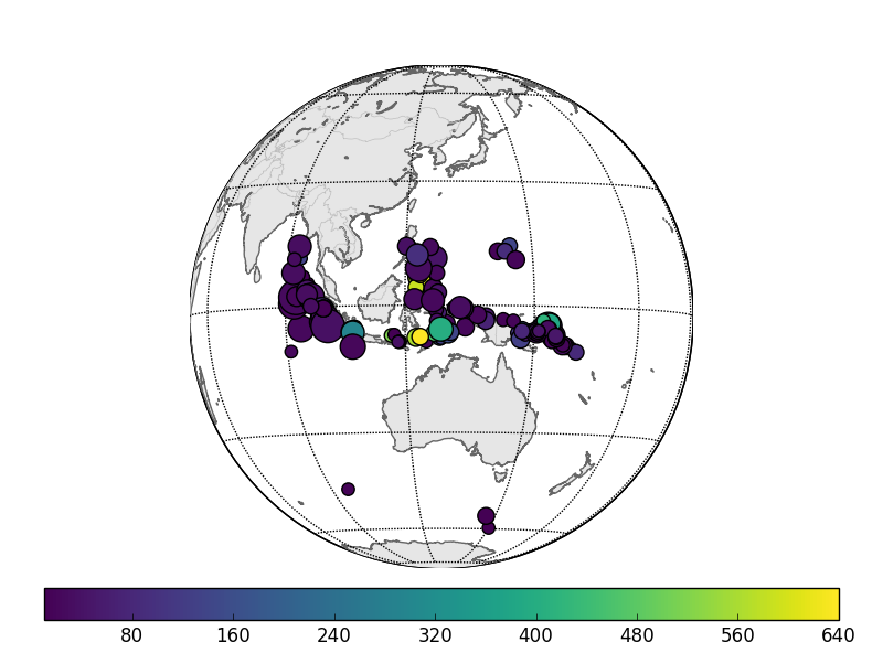
100+ events
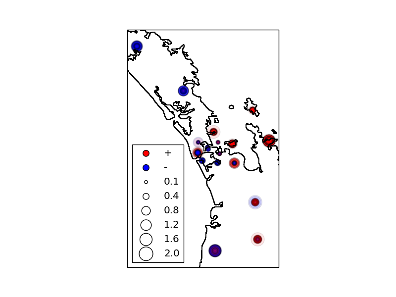
The output residuals at every stations are plotted on a map to gauge the underlying trend in velocity field. Red color on the map shows positive residual which means larger than average value thus a slow field and vice versa for blue. The size of the circle shows how big is the residual. The indication is that there is a prevalent slow region to the east of the AVF.
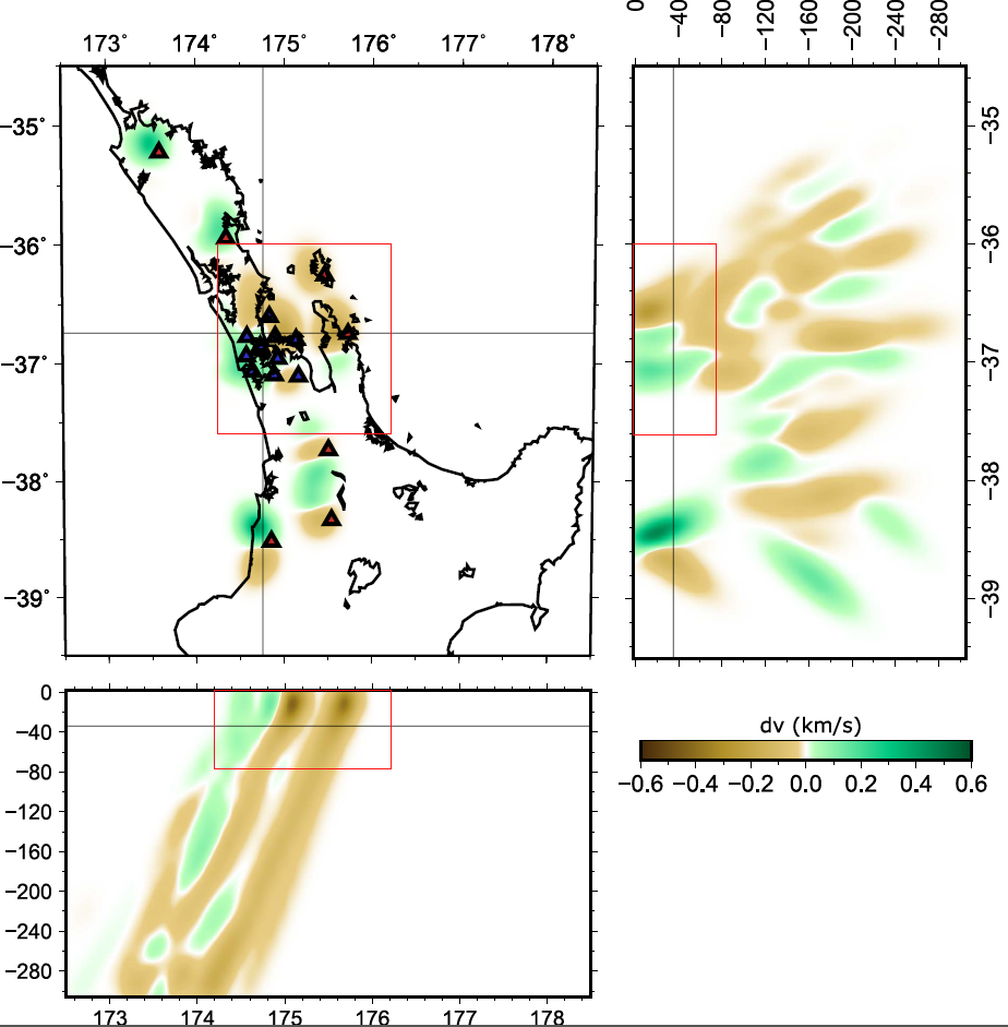
Inversion improve the preliminary trend by showing with more precision the split from positive to negative anomaly. The split is striking Northwest-Southeast extending to 80 km deep. We interpret this to be related to the Junction Magnetic anomaly of the Dun Mountain Ophiolite Belt.
Teleseismic inversion
Comments are closed.