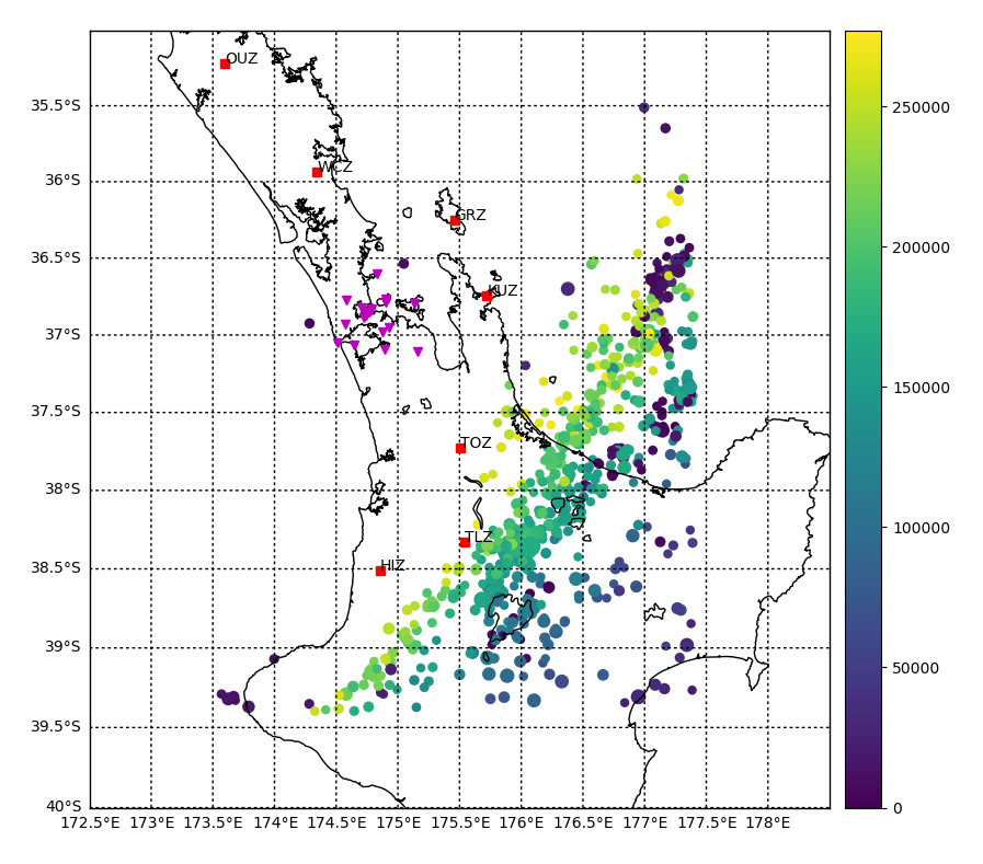
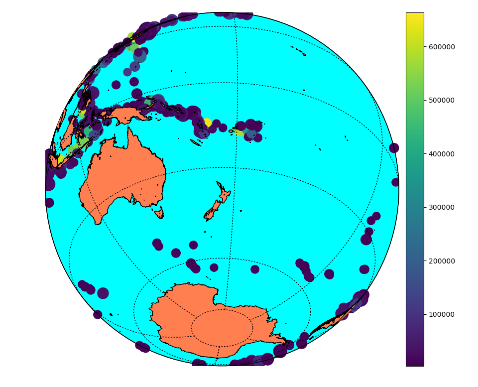
We propose to perform P-wave tomography to infer the structure beneath the AVF, with Nick Rawlinson’s FMTOMO. Our first step is to establish the resolution that we can expect from this exercise. Below, we plot the locations of the earthquakes — a total of 1330 cataloged events, 681 local + 649 teleseismic — used in this test:
- Local sources
- Teleseismic sources
The local events made up the sources coming in from the southeast of the receivers array. Whereas teleseismic sources complement this with incoming rays from other directions but most notably from the Northwest.
We compute synthetic seismic P-wave arrival times for the AVF seismic stations, as if the earth structure under the AVF has a checker-board pattern. For this test, this will be our “true” model of the Earth. And so the objective of this test is to invert these synthetic travel times to recover the “true” model checker-board pattern. Regions where the inverted results show a checker-board pattern suggest a good resolution. And the size of each checker-board pattern imply the size of the smallest feature resolvable.
Coarse Checker-board Test
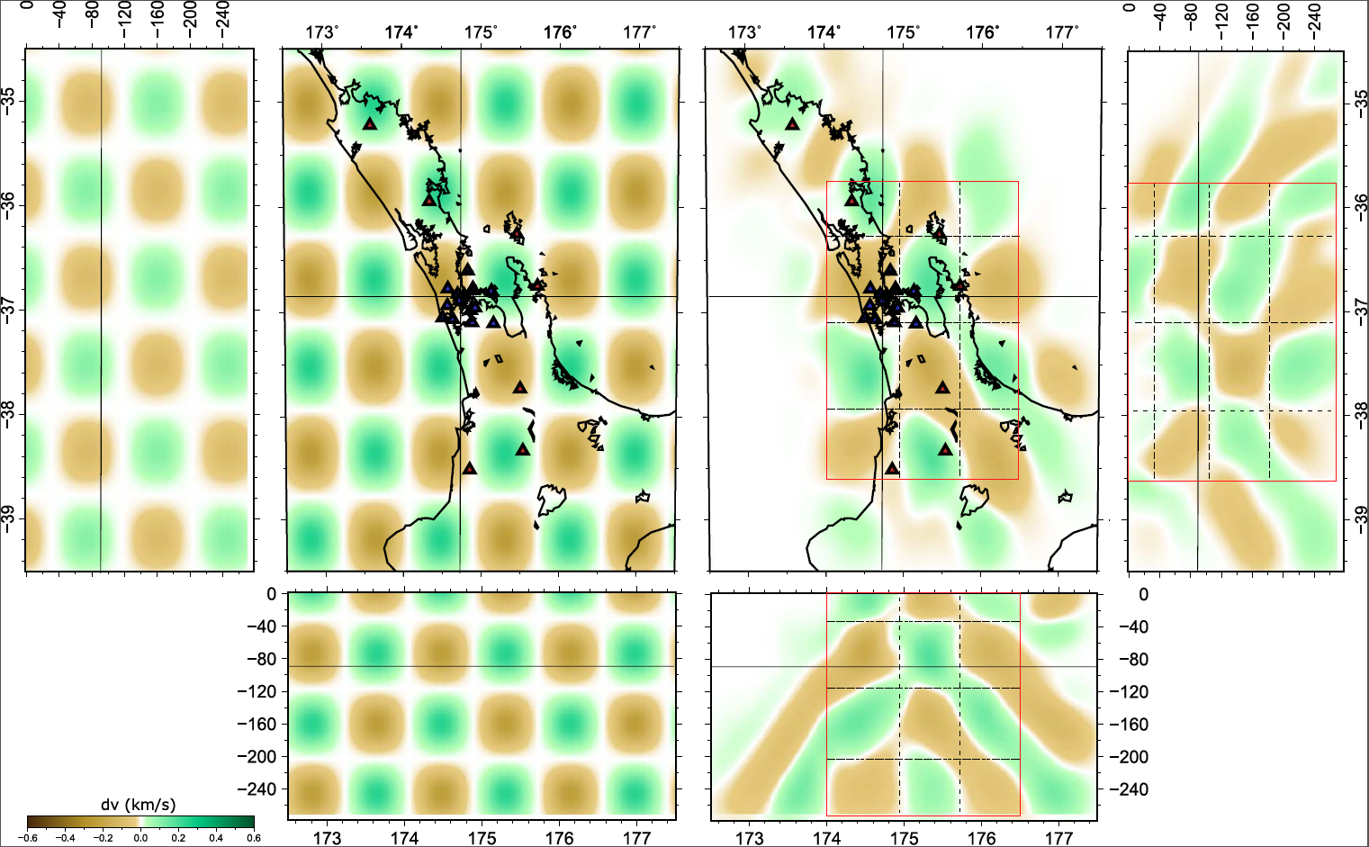
The first checker-board model shall have a wide grid spacing creating a fairly large checker-board patterns. In the following image, the ensuing checker-board model is represented by the three panels on the left while its recovery after the inversion is represented by the panels on the right.
- Dimension of the region where resolution is most exemplary is signified by the red box, ranging from Northland to Waikato, and to 280 km depth.
- Outside of the box, the smearing artefact is too prominent. Caused by ray paths having similar orientation.
- Within the box, the size of the features that are resolvable, corresponds to the size of each checker-board, is in the order of 60 km.
Fine Checker-board Test
We reduce the grid spacing, creating a smaller sized checker-board model, inferring that smaller features now have the potential to be resolved.
- The red box where resolution is commendable, is now span over the Auckland region, down to about 80 km deep.
- Within this box, subsurface features on the scale of 30 km can be resolved.


Comments are closed.