Estimating debris flow characteristics from near-field seismic signals
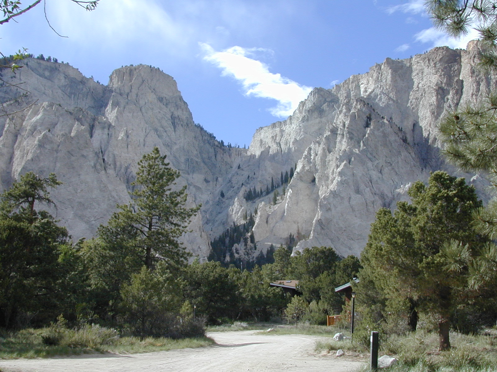
Debris flows can be devastating events. Seismic waves are likely to contain important information about the processes and properties of debris flows. We intend to study these largely unknown relations between seismic signatures and properties of debris flows. Seismic data was recorded in Chalk Cliffs, Colorado USA, in the vicinity of debris flows in geothermally weakened granite.
Data Acquisition
Seismic stations are located as in Table One.
We have previously been using a map as provided by IRIS in the following location:
http://www.iris.edu/gmap/Y7?timewindow=2009-2010
Data Acquisition
We have seismic data recorded from mid-2009 to mid-2010 in the Chalk Creek, Colorado area. This data was stored with IRIS in Washington, running from 05/14/09-05/31/10. Not all stations are continuously active during this period.
Presentation and Processing of Data
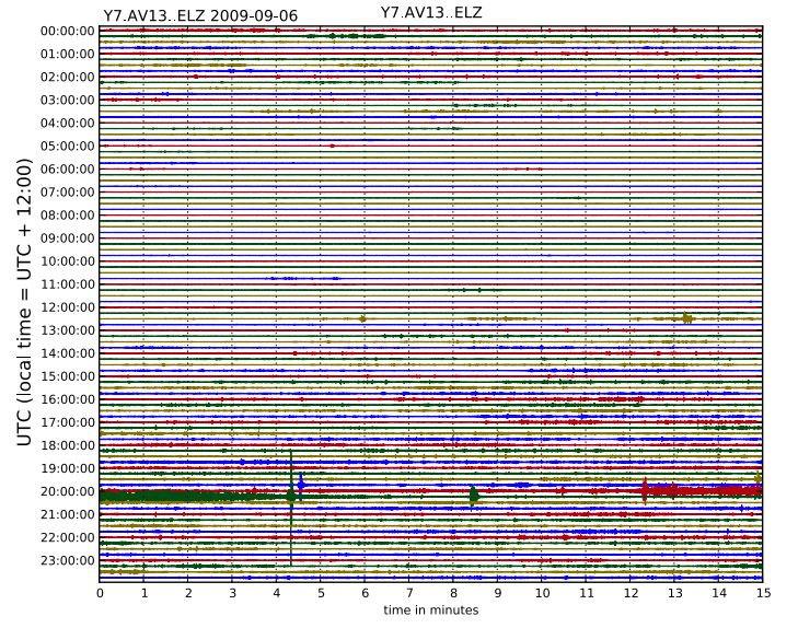
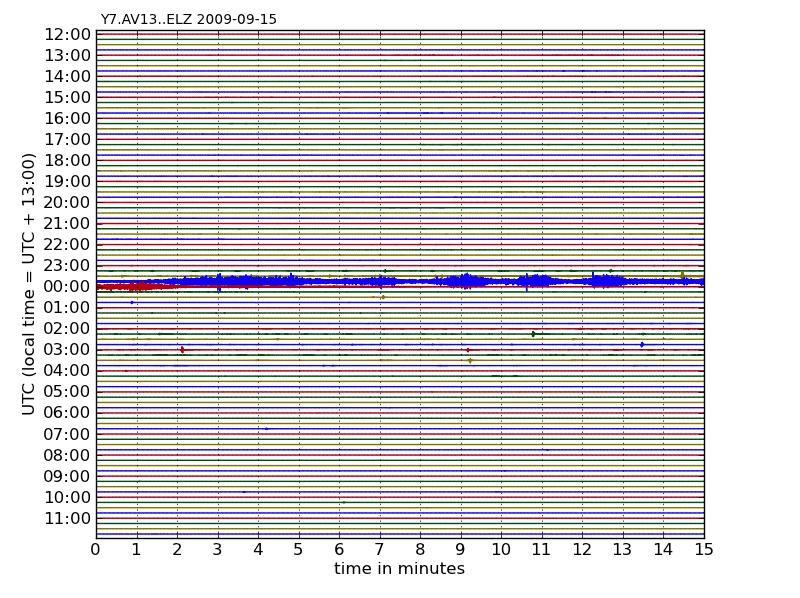
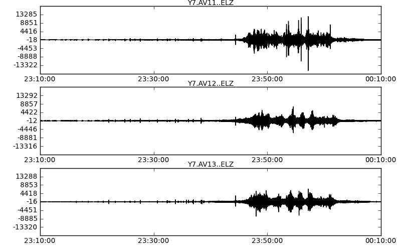
Plots covering the span of 24 hrs were then made for visual analysis using obspy in python.
These plots were then analysed visually for any events of a significant magnitude. Shape was compared to that described as the typical ‘cigar shape’ (‘Characterization of alpine rockslides using statistical analysis of seismic signals.’ Dammeier, F., Moore, J., Haslinger, F., & Loew, S. (2011)).

Dammeier, F., Moore, J., Haslinger, F., & Loew, S. (2011). Characterization of alpine rockslides using statistical analysis of seismic signals Journal of Geophysical Research, 116
Information provided by the USGS as to their observations of debris flows in this period was also considered.
We initially used the ELZ signal, and correlated it with the ELN and ELE.
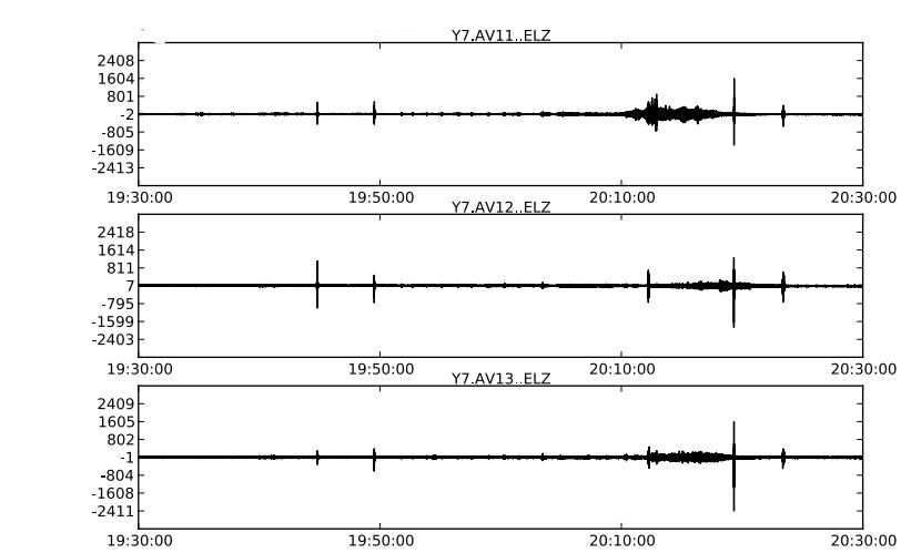
Where an event was thought to have occurred a one hour window was obtained using obspy in python.
Identified Debris Flows and external data
From this analysis we found two debris flows:
- 15th September 2009, 23:10
- 6th September 2009, 19:30
These dates and times are in UTC-datetime. The time offset in Colorado was UTC -7h during Standard Time, and UTC-6h during Daylight Saving. Daylight Saving in Colorado in 2009 was between March 8th and November 1st.
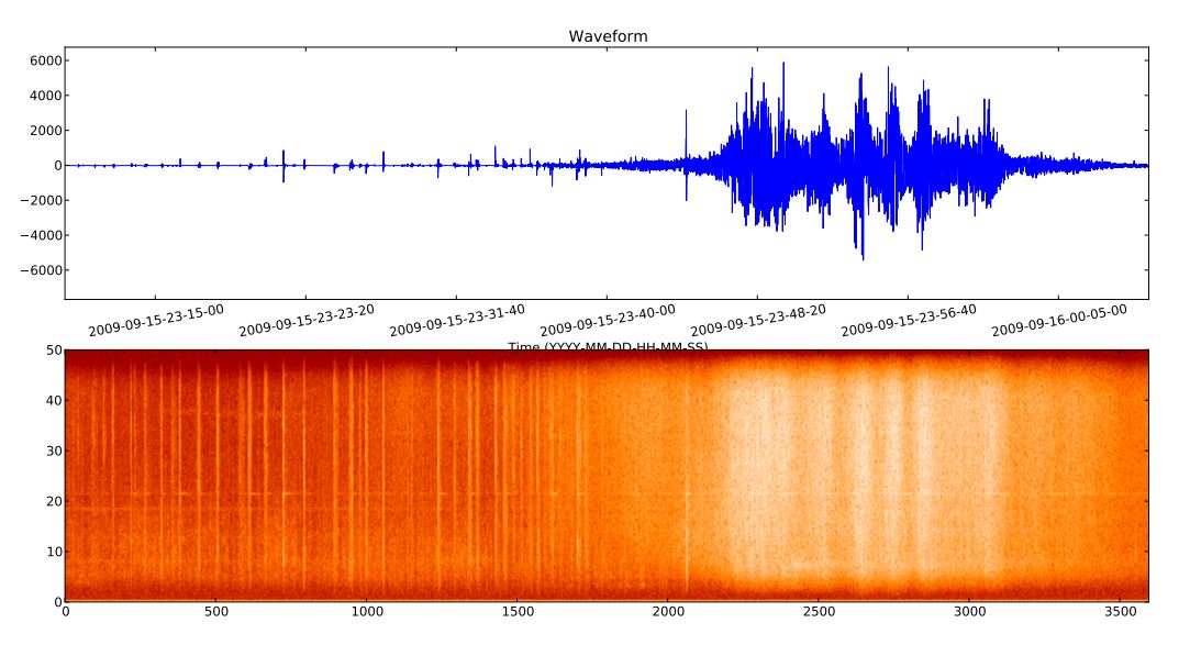
The flow on the 15th of September was much larger. Data for this slide, including basal normal force and stress, rain intensity, peak mean flow depth, volume, pore fluid pressure, entrainment, flow velocity and maximum discharge, was collected for the USGS. Video of the flow was also recorded, available from this location:
http://landslides.usgs.gov/monitoring/chalk_cliffs/rtd/video/index.php
We have access to weather data logged in Buena Vista, close to the landslide sites, from the National Oceanic and Atmosphere Administration in the US.
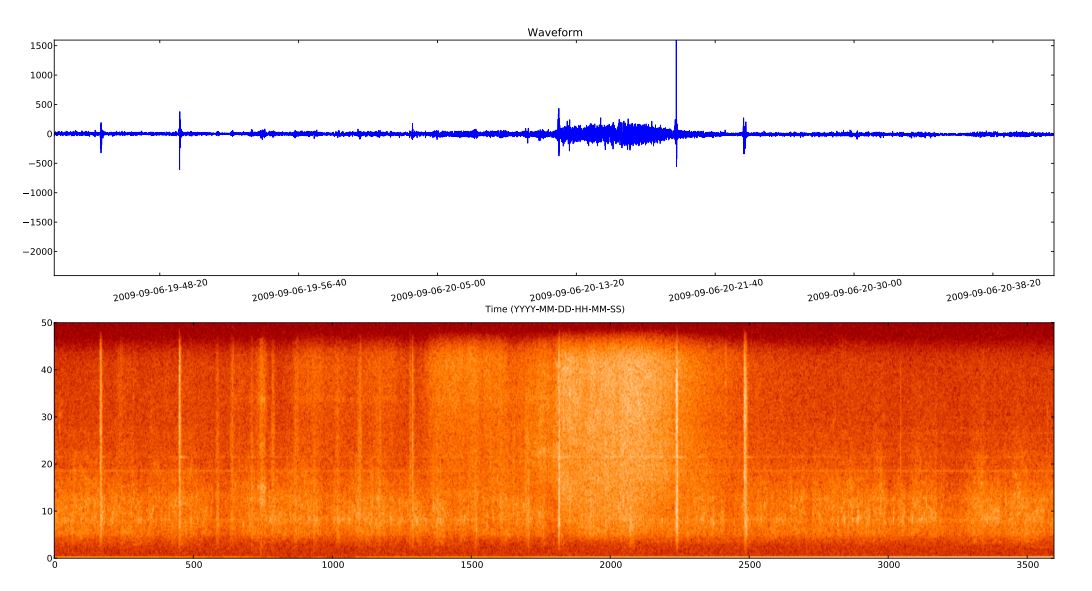
6th September 2009
15th September 2009
Frequency distribution analysis was also plotted for both of these flows.
6th September
It is possible that there are other, smaller events within our data set, and we are in the process of sorting the data to find anything that may have been on a magnitude such that it was overlooked.
Other data
The USGS have an ongoing data collection from this site, and were recording at the time that the seismic stations were active, so they have a range of data that we can match with ours.
http://landslides.usgs.gov/monitoring/chalk_cliffs/
Relevant Published Research
Chalk Cliffs has been an area of research interest, and several debris flow studies have been conducted there, although none relating to seismic signals. Monitoring by the USGS has been ongoing since 2008, and those working with that data have published plenty on the subject.
A lot of this research coincides with the period that the seismic stations were active. Three of these papers have data specifically pertaining to the flow on the 15th September. The others are also useful in understanding the regional geology, parameters that initiate and affect debris flows, and also the mechanics of debris flows (water versus sediment driven.)
Research of particular relevance is that of: G. Ekström & C. P. Stark.(2013). Simple Scaling of Catastrophic Landslide Dynamics, Science 339, 1416.
Ekström and Stark used distant seismic signals from the global seismic network to determine some properties of catastrophic landslides, such as maximum force, location and runout distance. With this information they collated these panels, which show the logarithmic relationships between certain properties.

G. Ekström & C. P. Stark.(2013). Simple Scaling of Catastrophic Landslide Dynamics, Science 339, 1416.
What we would like to do is extrapolate these plots for smaller scale events recorded much closer to the source. This involves adapting an algorithm developed by Ekstrom that puts the debris flow signals on the Moment Magnitude scale. We are in the process of understanding this and adapting it in our context, calibrating with global earthquakes recorded on our stations, and also checking it with the Tohoku Earthquake signal recorded on the global network. Once a magnitude is obtained for these flows, data provided by the USGS and extracted from the seismic signals are available to combine with the magnitude calculations, to eventually extrapolate those plots seen in Ekstrom’s research.
